Urban Heat and Flood Projection Analytics


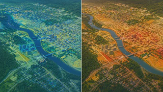
This research combines geospatial modeling, remote sensing, and AI to project urban heat and flood behavior under development and climate-change scenarios.
Focus
- Project urban heat island patterns and identify high-risk hotspots
- Map flood susceptibility and assess potential impacts on built environments
- Support scenario-based planning for municipalities and public agencies
Application
The framework supports resilience planning, emergency preparedness, and data-driven infrastructure upgrades.

Authors
Principal Investigator and Lab Director
Associate Professor at UNB working on geospatial AI, remote sensing, and urban digital twins for climate resilience and disaster management.

Authors
Master’s Student
Investigating Digital Twinning for Energy modeling applications.

Authors
PhD Student
Investigating accessible geospatial tools and workflows for accurate flood mapping in urban areas.